
SH-20 in Rogers County, OK
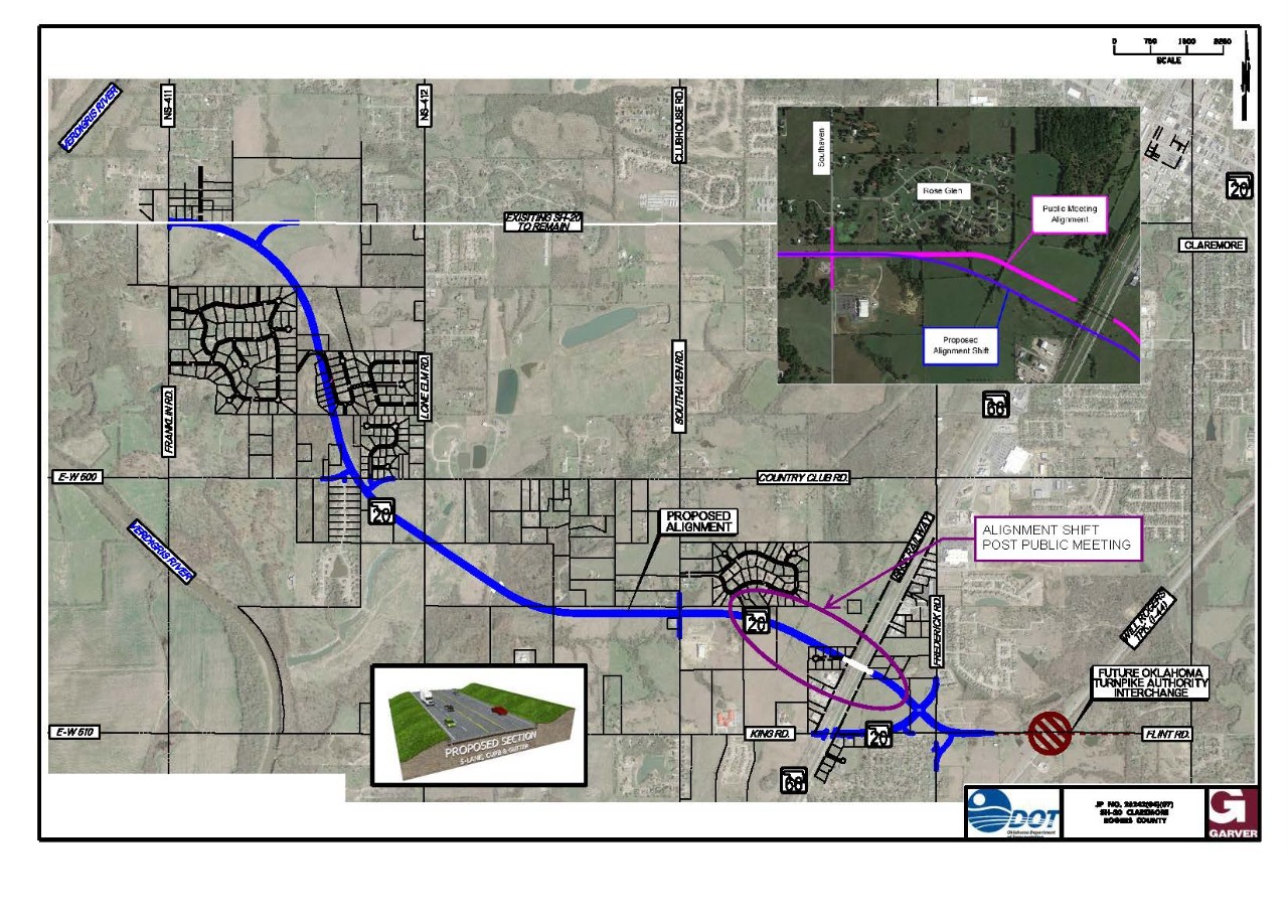
October 2018 Update - ODOT received numerous public comments and, upon a thorough evaluation of these comments, has revised the preferred alternative. Please see the image below to view the preferred alternative update.
Previous Public Meeting
PUBLIC MEETING SUMMARY AND RESPONSES TO COMMENTS
| Where | When |
| Claremore Conference Center 1400 Country Club Drive Claremore, OK 74017 (Map) |
Thursday, February 23, 2017 Public Meeting format Presentation at 6 p.m. |
Purpose:
The purpose of the Public Meeting was to present the proposed improvements for the segment of SH-20 from Franklin Road to Claremore, and get public input to aid the Department in moving forward with the completion of the detailed environmental studies to update the environmental review and project approval, design and construction.
Description:
The Oklahoma Department of Transportation (ODOT), in cooperation with the Federal Highway Administration (FHWA) is re-evaluating the Environmental Assessment (EA) for the realignment of SH- 20 between NW Franklin Road (NS-411) and SH-66 in Claremore in Rogers County. An EA for a 24-mile corridor of SH-20 from the US-75 junction west of Collinsville in Tulsa County east to Claremore in Rogers County was completed by ODOT in 2000. The EA resulted in a Finding of No Signifi cant Impact (FONSI) from FHWA. This project’s original scope was to improve the highway to a 4-lane divided highway in rural areas and a 4-lane undivided urban highway in Collinsville and a 4-lane divided highway with full access control around Claremore. Due to changes in the land use and traffi c, and to minimize right-ofway acquisition, the segments of SH-20 from Collinsville to Franklin Road have been designed or constructed as a 5-lane highway with 2 through lanes in each direction and a center turn lane. The purpose of the project is to improve safety and mobility of the traffi c on SH-20. ODOT has tasked a consultant to look at alternatives for improving the originally proposed alignment taking into consideration construction costs, right-of-way and utility costs and current environmental constraints.
The proposed improvements include constructing a fi ve-lane curb and gutter section, including two 12-footwide inside lanes, two 14-foot wide outside lanes with curb and gutter and a 14-foot-wide center turn lane on the new alignment as approved in the original EA. The existing SH-20 through town will be left in place as local road to provide access to properties. The modifi ed alignment of SH-20 will cross over SH-66 and the railroad near the King/Flint Road intersection. SH-20 will follow SH-66 via King Road to downtown Claremore, where it will meet the existing SH-20. Improvements will be made to the SH-66/King Road intersection to improve traffic operations. The Oklahoma Turnpike Authority (OTA) is proposing to construct a new interchange on the Will Rogers Turnpike (I-44) just east of SH-20 near Flint Road as a separate project.
Comments:
ALL COMMENTS NEED TO BE RECEIVED BY THE END OF BUSINESS ON March 9, 2017
Submit Online: COMMENT FORM
NOTE: To submit this Comment Form by email please download the form. Use your Adobe Reader to fill in your information and leave your comment, then select the Submit by Email button. You can also fill in the downloaded form and send it as an email attachment if you are on a public computer, or email your comments to environment@odot.org. If you do not currently have an Adobe Reader, you can download a free copy at https://get.adobe.com/reader/.
Email: environment@odot.org
Address:
ODOT Environmental Programs Division
OKLAHOMA DEPARTMENT OF TRANSPORTATION
200 N.E. 21st Street
Oklahoma City, OK 73105-3204
Downloads: