
FOR IMMEDIATE RELEASE
May 17, 2016
PR# 16-022
Drivers in eastern Oklahoma now have new signs in place to alert them to one of Oklahoma’s busiest “new” highways. The McClellan-Kerr Arkansas River Navigation System (MKARNS) was designated as a national Marine Highway Corridor in 2015 and signs are now in place at key bridges over this waterway to identify when drivers are crossing over this new section of the M-40 Marine Highway thanks to the efforts from two state agencies.
The MKARNS is a 445-mile stretch of waterway connecting Oklahoma to the Gulf of Mexico with a system of ports stretching from Catoosa east through Arkansas to join with the Mississippi River. The Oklahoma Department of Transportation’s Waterways Branch Manager Deidre Smith and the Arkansas Waterways Commission Executive Director Gene Higginbotham worked together to apply for a change from a “Connector” to a “Corridor” designation on the MKARNS which will help with the continued growth of the system. They also collaborated to create the first Marine Highway signage in the nation which will be posted on bridges over the MKARNS in both Oklahoma and Arkansas.
The marine highway corridor designation elevates the MKARNS to the same status level as 11 other large waterway systems nationwide including the Mississippi and Ohio Rivers and gives it a higher priority in future funding opportunities for improvements
“The efforts of the waterways offices in both Oklahoma and Arkansas to sponsor this upgrade helps ensure that the MKARNS is recognized not just nationally but also here at home," ODOT Executive Director Mike Patterson said. “The new signs are now in place along seven bridges over the navigation system in Oklahoma, which will help the traveling public understand the path and importance of this system.
This upgrade reflects the continued growth of the system, which also helps with flood control management and is a recreational draw in the region. The MKARNS had a nearly eight percent increase in freight shipments in the past two years, and the 2015 tonnage in both Oklahoma and Arkansas totaled nearly ten million tons with a value of nearly $4 billion.
In 2015, almost five million tons of goods were moved by barge on the Oklahoma segment, valued at about $2.2 billion. Besides being a major economic force in Oklahoma and the surrounding region, the MKARNS also relieves the highway system from congestion and wear-and-tear. Just one barge can transport the equivalent of 15 jumbo railcars or 60 large semi-trucks. Barge shipments also help reduce air emissions and fuel consumption by 40% compared to rail and 270% by truck, making it an environmentally-friendly and cost-effective means of transportation.
---www.odot.org---
Captions:
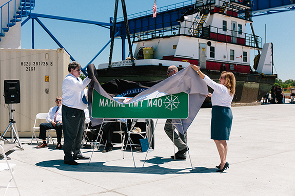
Photo 1 - Arkansas Waterways Commission Executive Director Gene Higginbotham and Oklahoma Department of Transportation Waterways Branch Manager Deidre Smith unveil the new Marine Highway signs for the McClellan-Kerr Arkansas River Navigation System (MKARNS) on May 10, 2016. The new signs will be in place along seven Oklahoma highway bridges over the navigation system, to help the travelling public understand the path and importance of this system. This 445-mile waterway connects ports in Oklahoma and Arkansas to the Gulf of Mexico and helped transport about $2.2 billion goods in Oklahoma last year.
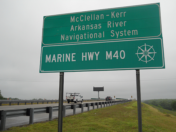
Photo 2 – One of the new signs showing the new Marine Highway M-40 designation for the McClellan-Kerr Arkansas River Navigation System (MKARNS) in Oklahoma. These signs are now in place on highway bridges crossing over the waterway.